Disaster strikes HF Radar research programme
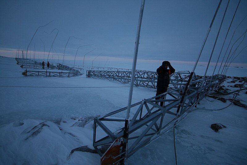
The recent winds did more than just topple weather records – today we discovered the wind had also flattened all but one of the towers which support the HF radar antenna.
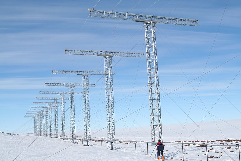
SANAE IV’s HF radar (pictured in the photo above, taken last summer) is the largest of the scientific research installations at Vesleskarvet. 16 T-shaped towers stood 15m high in an east-west line more than 200m long, supporting a grid of aluminium antenna elements which collectively transmit and receive signals allowing scientists to study the upper atmosphere over the South Pole. Our radar is part of a network of similar stations all around Antarctica which contribute data to create three-dimensional images (eg. of the ionosphere over the Pole) which is then fed to collaborative groups of scientists around the world (the SHARE and SuperDARN projects).
The same hurricane-force winds which damaged my tent caused failure of one of the anchors of the radar, causing 15 of the 16 towers to fall like dominoes. The damage is beyond our facilities and supplies to repair; a full-blown reconstruction will have to take place in summer. Still, there is a silver lining: reconstructing the radar allows changes and upgrades to the design to be implemented. Antarctica might be the most challenging earth-bound location to conduct scientific investigation, but she is still an awesome laboratory and window on the universe. Besides – if it were easy, it wouldn’t be fun.

